File:Callichroma auricomum MHNT femelle3.jpg

From Wikispecies
Jump to navigation Jump to search

Original file(2,867 × 3,945 pixels, file size: 2.7 MB, MIME type: image/jpeg)

This file is from Wikimedia Commons and may be used by other projects. The description on its file description page there is shown below.

Summary

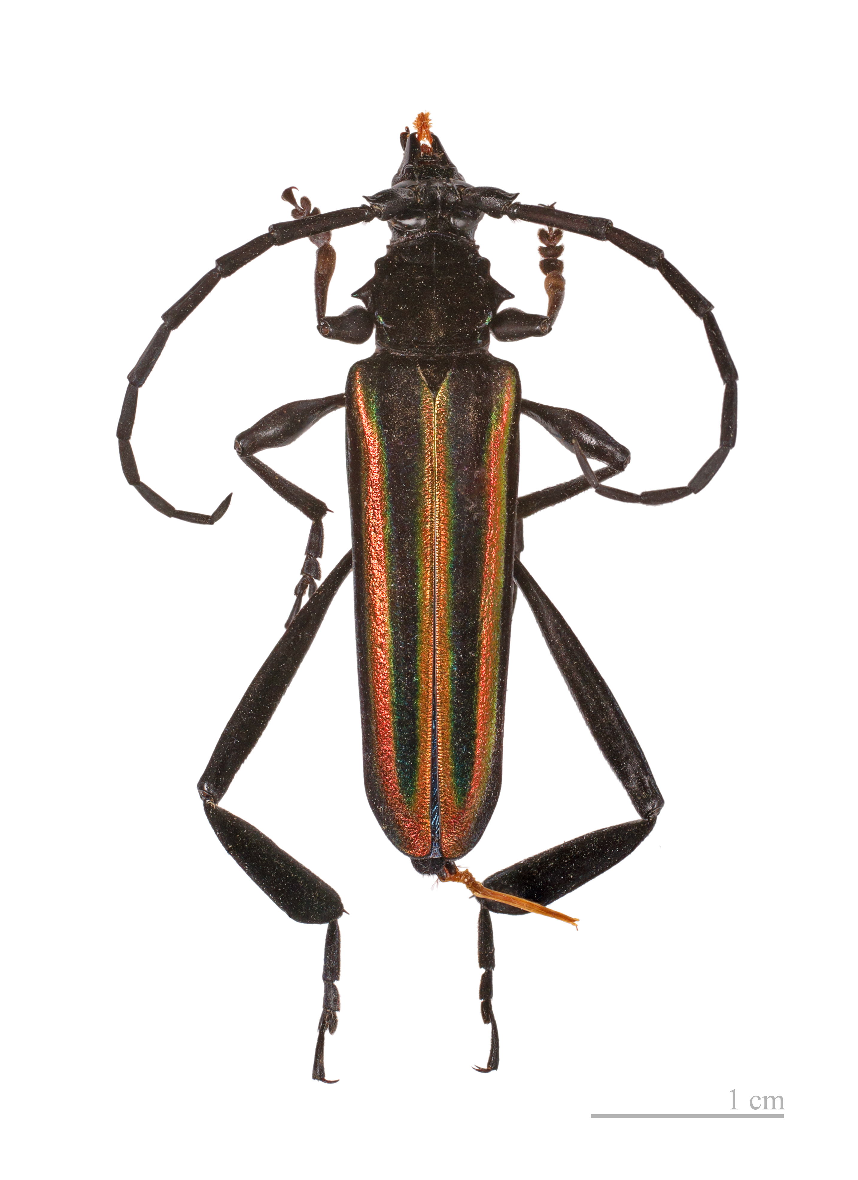
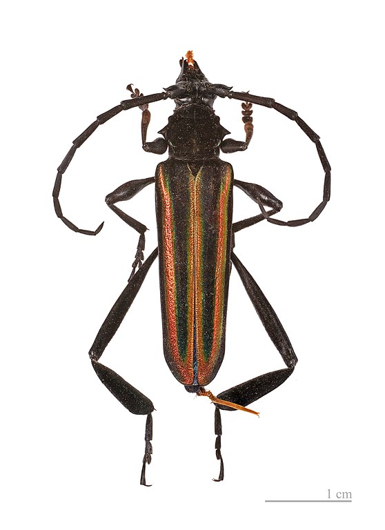
Callichroma auricomum (Linnaeus, 1767)

VI seal

This image has been assessed under the valued image criteria and is considered the most valued image on Commons within the scope: Callichroma auricomum mounted specimen femelle dorsal. You can see its nomination here.

Focus stacking of 3 pictures.

Description
Deutsch: - Dorsalansicht
Fundort : Straße von Kaw, Carbet von Nationalen Wälder Büro, Französisch-Guayana.
English: - Dorsal side
Locality : Kaw road, Carbet of National Forests Office, French Guiana.
Français : - Face dorsale
Localité: Route de Kaw, Carbet de l’ Office national des forêts, Guyane, France.
institution QS:P195,Q422
MNHT.CUT.2011.0.183
Date Taken on 30 December 2011
Source Own work
Author Didier Descouens
Permission
(Reusing this file)
This file is copyrighted and has been released under a license which is incompatible with Facebook's licensing terms. It is not permitted to upload this file at Facebook.
I, the copyright holder of this work, hereby publish it under the following license:
w:en:Creative Commons
attribution share alike
This file is licensed under the Creative Commons Attribution-Share Alike 4.0 International license.
You are free:
  • to share – to copy, distribute and transmit the work
  • to remix – to adapt the work
Under the following conditions:
  • attribution – You must give appropriate credit, provide a link to the license, and indicate if changes were made. You may do so in any reasonable manner, but not in any way that suggests the licensor endorses you or your use.
  • share alike – If you remix, transform, or build upon the material, you must distribute your contributions under the same or compatible license as the original.
Other versions
Camera location43° 35′ 38.03″ N, 1° 26′ 57.23″ E Kartographer map based on OpenStreetMap.View this and other nearby images on: OpenStreetMapinfo

Captions

Add a one-line explanation of what this file represents

Items portrayed in this file

depicts

30 December 2011

43°35'38.02980593962"N, 1°26'57.22698211670"E

image/jpeg

19be2f5ed250c1d5a86cdf9837a2cba1c14e7785

2,828,307 byte

3,945 pixel

2,867 pixel

File history

Click on a date/time to view the file as it appeared at that time.

Date/TimeThumbnailDimensionsUserComment
current10:50, 31 December 2011Thumbnail for version as of 10:50, 31 December 20112,867 × 3,945 (2.7 MB)Archaeodontosaurus{{Information |Description ={{en|1=x}} |Source ={{own}} |Author =Archaeodontosaurus |Date = |Permission = |other_versions = }}

The following page uses this file:

Global file usage

The following other wikis use this file:

Metadata