File:Angela guianensis MHNT male vol.jpg

From Wikispecies
Jump to navigation Jump to search

Original file(4,652 × 6,488 pixels, file size: 4.98 MB, MIME type: image/jpeg)

This file is from Wikimedia Commons and may be used by other projects. The description on its file description page there is shown below.

Summary

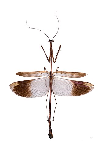
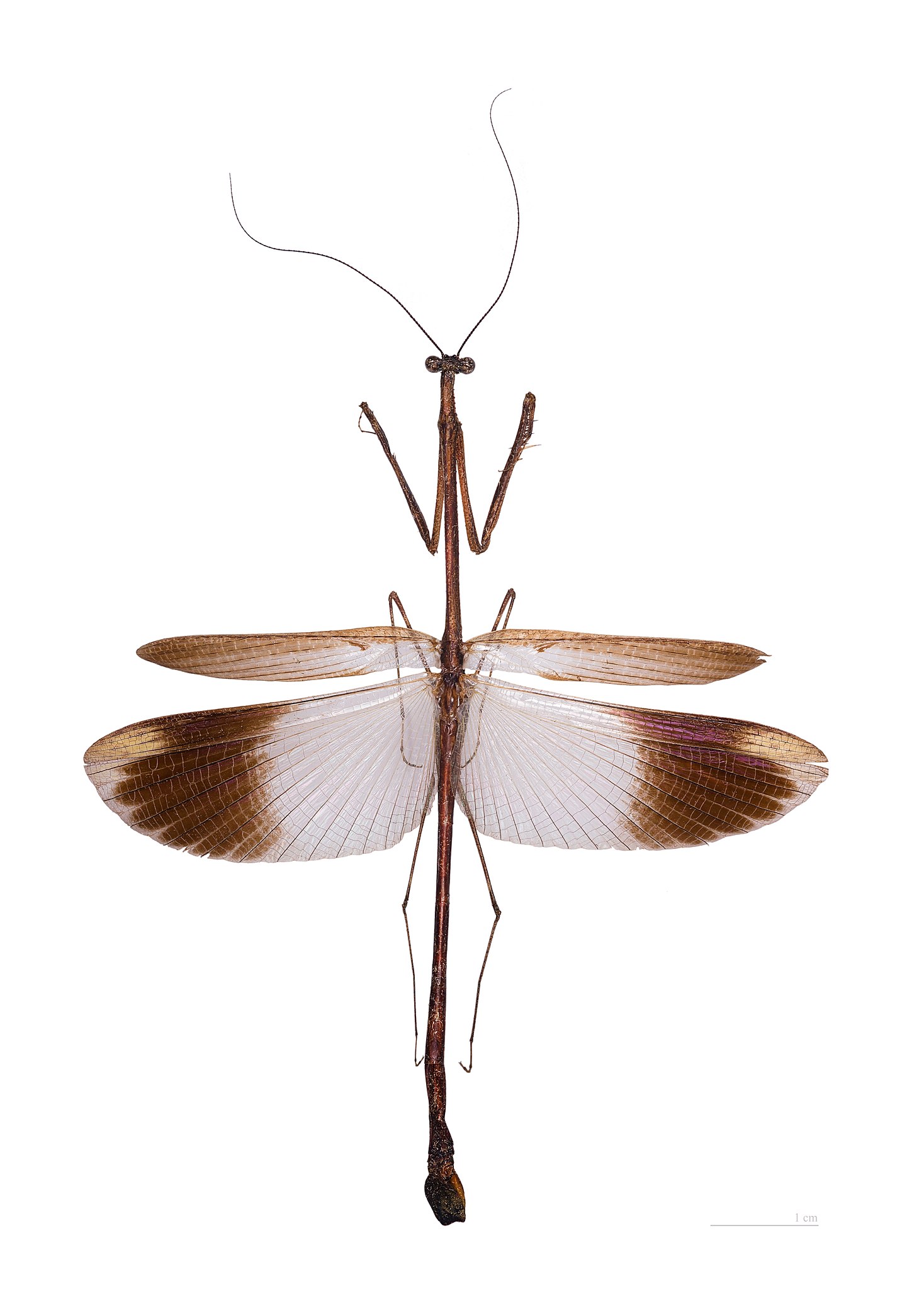
Angela guianensis Rehn, 1906

Featured picture
Valued image
Valued image
This file is marked as a valued image, but it is missing its scope! Please refer to Template:Assessments/doc!

Wikimedia CommonsWikipedia

This is a featured picture' on Wikimedia Commons (Featured pictures) and is considered one of the finest images. See its nomination here.
This image has been assessed under the valued image criteria and is considered the most
valued image on Commons within the scope '.

 This is a featured picture on the Persian language Wikipedia (نگاره‌های برگزیده) and is considered one of the finest images. See its nomination here.

If you have an image of similar quality that can be published under a suitable copyright license, be sure to upload it, tag it, and nominate it.

Description
Deutsch: - Flug Stellung
Fundort : Route de Kaw, Carbet Orstom, Französisch-Guayana.
English: - Flight position
Locality : Route de Kaw, Carbet Orstom, French Guiana.
Français : - position de vol
Localité : Route de Kaw, Carbet Orstom, Guyane, France.
institution QS:P195,Q422
Date
Source Own work
Author Didier Descouens
Permission
(Reusing this file)
I, the copyright holder of this work, hereby publish it under the following license:
w:en:Creative Commons
attribution share alike
This file is licensed under the Creative Commons Attribution-Share Alike 3.0 Unported license.
You are free:
  • to share – to copy, distribute and transmit the work
  • to remix – to adapt the work
Under the following conditions:
  • attribution – You must give appropriate credit, provide a link to the license, and indicate if changes were made. You may do so in any reasonable manner, but not in any way that suggests the licensor endorses you or your use.
  • share alike – If you remix, transform, or build upon the material, you must distribute your contributions under the same or compatible license as the original.
Camera location43° 35′ 38.03″ N, 1° 26′ 57.23″ E Kartographer map based on OpenStreetMap.View this and other nearby images on: OpenStreetMapinfo

Captions

Add a one-line explanation of what this file represents

Items portrayed in this file

depicts

26 December 2011

43°35'38.02980593962"N, 1°26'57.22698211670"E

image/jpeg

5cefc7d7060b0d6a25e843c64835eaca2495d1dc

5,219,052 byte

6,488 pixel

4,652 pixel

File history

Click on a date/time to view the file as it appeared at that time.

Date/TimeThumbnailDimensionsUserComment
current14:45, 26 December 2011Thumbnail for version as of 14:45, 26 December 20114,652 × 6,488 (4.98 MB)Archaeodontosaurus{{Information |Description ={{en|1=x}} |Source ={{own}} |Author =Archaeodontosaurus |Date = |Permission = |other_versions = }}

The following 3 pages use this file:

Global file usage

Metadata