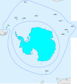
File:WGSRPD Antarctic.svg
Jump to navigation
Jump to search

Size of this PNG preview of this SVG file: 559 × 600 pixels. Other resolutions: 224 × 240 pixels | 448 × 480 pixels | 716 × 768 pixels | 955 × 1,024 pixels | 1,910 × 2,048 pixels | 2,580 × 2,767 pixels.
Original file (SVG file, nominally 2,580 × 2,767 pixels, file size: 133 KB)
File history
Click on a date/time to view the file as it appeared at that time.
| Date/Time | Thumbnail | Dimensions | User | Comment | |
|---|---|---|---|---|---|
| current | 17:47, 29 July 2015 |  | 2,580 × 2,767 (133 KB) | Peter coxhead | Inner boundary of Subantarctic Islands added |
| 17:37, 29 July 2015 |  | 2,580 × 2,767 (132 KB) | Peter coxhead | Labels corrected | |
| 17:16, 29 July 2015 |  | 2,580 × 2,767 (132 KB) | Peter coxhead | User created page with UploadWizard |
File usage
The following page uses this file:
Global file usage
The following other wikis use this file:
- Usage on en.wikipedia.org
- Category:Flora of Antarctica
- Category:Biota of Antarctica
- Category:Natural history of Antarctica
- Category:Fauna of Antarctica
- Category:Flora of the Antarctic
- Category:Subantarctic
- Category:Fauna of subantarctic islands
- Wikipedia:WikiProject Plants/World Geographical Scheme for Recording Plant Distributions
- Category:Fungi of Antarctica
- User:DexDor/Categorization of organisms by geography
- Category:Flora of the subantarctic islands
- Category:Antarctic realm
- Category:Antarctic realm biota
- Category:Antarctic realm fauna
- Category:Vertebrates of Antarctica
- Category:Lichens of Antarctica
- Category:Lichens of the Antarctic
- Category:Lichens of the subantarctic islands
- Usage on es.wikipedia.org
- Usage on hr.wikipedia.org
- Usage on tr.wikipedia.org
- Kategori:Antarktika faunası
- Kategori:Antarktika'da doğa tarihi
- Kategori:Subantarktik
- Kategori:Antarktika florası
- Kategori:Antarktika biyotası
- Kategori:Subantarktik adaları faunası
- Kategori:Antarktik biyocoğrafik bölgesi
- Kategori:Antarktik biyocoğrafik bölgesi biyotası
- Kategori:Antarktik biyocoğrafik bölgesi faunası
- Kategori:Subantarktik adaları florası
- Kategori:Antarktik biyocoğrafik bölgesi florası
- Kategori:Antarktika kuşları
- Kategori:Antarktika omurgalıları
- Usage on zh.wikipedia.org